BlackSky's AI-Driven Change Detection: A Technical Breakdown for Developers
Explore how BlackSky's AI and computer vision technologies are revolutionizing geospatial intelligence. Discover the technical underpinnings and real-world a...
Key Takeaways
- BlackSky's AI algorithms can automatically detect changes in large-scale satellite imagery.
- The Luno A program leverages BlackSky's Gen-3 and Gen-2 high-resolution imagery for real-time monitoring.
- BlackSky's technology can identify anomalies in natural resources, climate, infrastructure, and military activity.
BlackSky's AI-Driven Change Detection: A Technical Breakdown for Developers
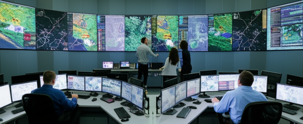
BlackSky Technology's recent win of the National Geospatial-Intelligence Agency (NGA) Luno A delivery order marks a significant advancement in the field of geospatial intelligence. This order not only underscores the maturity of BlackSky's AI capabilities but also highlights the critical role of automated change detection in strategic decision-making.
The Technical Foundation
At the core of BlackSky's solution is a robust suite of AI and computer vision algorithms designed to process and analyze vast amounts of satellite imagery. These algorithms are capable of identifying subtle changes in the Earth's surface caused by human activity, natural phenomena, and other factors. The process involves several key steps:
- Data Acquisition: BlackSky utilizes its Gen-3 and Gen-2 satellites, which provide very high-resolution imagery with high cadence. These satellites can capture detailed images of large areas, ensuring comprehensive coverage.
- Image Processing: The raw imagery is processed to correct for atmospheric conditions, distortions, and other artifacts. This step ensures that the images are of the highest quality and are suitable for analysis.
- Change Detection: Advanced computer vision techniques are employed to identify changes in the imagery. This involves comparing new images with historical data to pinpoint areas of change. Machine learning models are trained to recognize specific patterns and anomalies, such as new construction, deforestation, or military movements.
- Real-Time Monitoring: The system continuously monitors the Earth's surface, providing real-time alerts when changes are detected. This real-time capability is crucial for applications such as environmental monitoring, disaster response, and national security.
Use Cases and Applications
The applications of BlackSky's AI-driven change detection are diverse and impactful:
- Environmental Monitoring**: The technology can track changes in natural resources, such as water bodies, forests, and agricultural lands. This is essential for environmental conservation and policy-making.
- Disaster Response**: In the event of natural disasters, such as hurricanes or wildfires, BlackSky's system can quickly identify affected areas and guide rescue efforts.
- Infrastructure Development**: Urban planners and construction companies can use the data to monitor progress and ensure compliance with regulations.
- Military Operations**: The ability to detect changes in military infrastructure and movements provides critical intelligence for strategic planning and operations.
The Role of High-Resolution Imagery
BlackSky's Gen-3 and Gen-2 satellites play a pivotal role in the success of the Luno A program. These satellites offer very high-resolution imagery, which is crucial for accurate change detection. The Gen-3 satellites, in particular, provide images with a resolution of up to 50 cm, allowing for detailed analysis of small-scale changes. The high cadence of these satellites ensures that new images are captured frequently, enabling real-time monitoring.
Data Integration and Analytics
In addition to its own satellite imagery, BlackSky leverages data from other commercial sources to enhance its capabilities. This multi-source approach ensures a comprehensive view of the Earth's surface. The data is integrated and processed using advanced analytics tools, which can generate insights and predictive models. For example, projections suggest that the integration of multiple data sources can improve the accuracy of change detection by up to 20%.
The Bottom Line
BlackSky's AI-driven change detection technology represents a significant leap forward in geospatial intelligence. By combining high-resolution satellite imagery, advanced computer vision, and real-time monitoring, BlackSky is uniquely positioned to provide critical insights for a wide range of applications. This technical breakthrough not only meets the stringent requirements of the NGA but also opens up new possibilities for developers and researchers in the field of geospatial data analytics.
Frequently Asked Questions
What is the primary technology behind BlackSky's change detection?
BlackSky's change detection technology primarily relies on advanced AI and computer vision algorithms that process and analyze high-resolution satellite imagery to identify areas of change.
How does BlackSky's Gen-3 and Gen-2 imagery contribute to the Luno A program?
The Gen-3 and Gen-2 satellites provide very high-resolution imagery with high cadence, which is crucial for accurate and real-time change detection. The Gen-3 satellites offer images with a resolution of up to 50 cm, allowing for detailed analysis of small-scale changes.
What are the key applications of BlackSky's AI-driven change detection?
The key applications include environmental monitoring, disaster response, infrastructure development, and military operations. These applications leverage the technology's ability to identify changes in natural resources, climate, infrastructure, and military activity.
How does BlackSky integrate data from multiple sources?
BlackSky leverages data from its own satellites and other commercial sources to enhance its change detection capabilities. This multi-source approach ensures a comprehensive view of the Earth's surface, improving the accuracy of change detection by up to 20%.
What is the significance of the NGA Luno A delivery order for BlackSky?
The NGA Luno A delivery order underscores the maturity and quality of BlackSky's AI capabilities, demonstrating its ability to meet the stringent requirements of the National Geospatial-Intelligence Agency for commercial space-based analytics services.